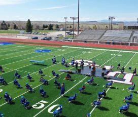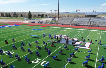


Elevated Mapping LLC. Drone Service provides all of your Drone, GIS & Mapping needs. Our FAA Certified Pilots can provide Drone and Geospatial services including Centimeter accurate GPS data location, Mapping, Aerial Imagery Collection, Roof, Building, Real Estate, and Property Inspections. Please contact us about the many options and services from Elevated Mapping Drone Service.
November, 2025
Saturday
6:30 am - 7:00 am
7:00 am - 7:30 am
7:30 am - 8:00 am
8:00 am - 8:30 am
8:30 am - 9:00 am
9:00 am - 9:30 am
9:30 am - 10:00 am
10:00 am - 10:30 am
10:30 am - 11:00 am
11:00 am - 11:30 am
11:30 am - 12:00 pm
12:00 pm - 12:30 pm
12:30 pm - 1:00 pm
1:00 pm - 1:30 pm
1:30 pm - 2:00 pm
2:00 pm - 2:30 pm
2:30 pm - 3:00 pm
3:00 pm - 3:30 pm
3:30 pm - 4:00 pm
4:00 pm - 4:30 pm
4:30 pm - 5:00 pm
5:00 pm - 5:30 pm
5:30 pm - 6:00 pm
6:00 pm - 6:30 pm
6:30 pm - 7:00 pm
7:00 pm - 7:30 pm
7:30 pm - 8:00 pm
8:00 pm - 8:30 pm
8:30 pm - 9:00 pm
9:00 pm - 9:30 pm
9:30 pm - 10:00 pm
10:00 pm - 10:30 pm
10:30 pm - 11:00 pm
11:00 pm - 11:30 pm
11:30 pm - 12:00 am
August 26,2019
Awesome Job!
We have received your appointment and will send you a confirmation to your provided email upon approval.
 Own or work here?
Claim Now!
Claim Now!
Own or work here?
Claim Now!
Claim Now!

/ Per Listing
Lorem ipsum dolor sit amet, lorem sit.
/ Per Listing
Lorem ipsum dolor sit amet, lorem sit.
Claim request is processed after verification..